

Sängerfels · Sunstar
The terrain edge decides the moment.
Celeris shows when the sun clears the actual horizon at the location, rather than only crossing the mathematical horizon.
 Celeris
Get app
Celeris
Get app
Celeris shows you any landscape shot before you take it: sun, moon, Milky Way and stars over the real terrain — by day, by night and in between. Choose a place, time and focal length and see what to expect, with fog, 3D and AR. Spend less time searching and more time outside with your camera.
No subscription. The app remains free to use; the full version is a one-time purchase.
iPhone & iPad from iOS 17 · Mac from macOS 26 · Android from version 10 · German and English · No Celeris account, no trackers

Plan meets reality
These photographs were made at real locations under the real sky. Celeris previews where the sun stands at the terrain edge, where the moon and the Milky Way come up over the land, and how star trails will run through the frame.
Sängerfels · Sunstar
Celeris shows when the sun clears the actual horizon at the location, rather than only crossing the mathematical horizon.
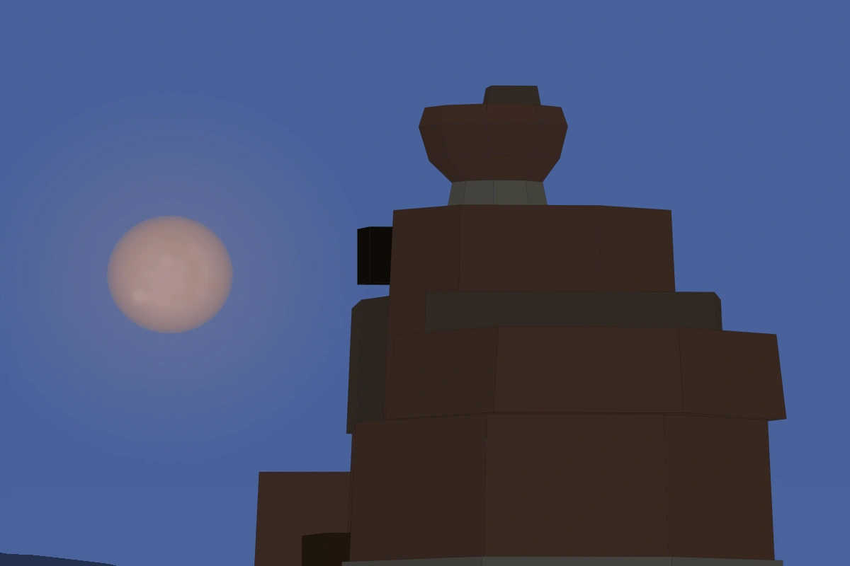

Drachenfels · Moon
Using the field of view, terrain and the included 3D model, Celeris previews where the moon will sit in relation to the subject.


Hochstein · Solar eclipse
Celeris calculates coverage for the selected location and brings the sun, moon, focal length and terrain together in one frame.


Hochstein · Milky Way
The Milky Way's path, altitude and field of view are shown together with the terrain line for the selected place and time.


Teufelstisch · Star trails
Choose an exposure, check the path and position the still celestial pole exactly where the photograph needs it.
Everything in one app
See when the sun, moon or stars actually clear a mountain — not just when they cross the mathematical horizon.
Rise and set directions, object paths, the Milky Way and your field of view appear directly on the map, so you know where to point the camera.
Slide through hours, days or months. The map, sky, twilight and events all update instantly for the selected moment.
Set focal length, direction and orientation. Celeris previews the composition with the sky, terrain and your subject in the frame.
Find nights that are astronomically dark and free from moonlight without comparing twilight and moon times yourself.
Search 8,920 stars and all 110 Messier objects. Selected deep-sky objects appear in the frame using real archive images.
Overlay the calculated sky on the live camera image. On location, it helps you recover the planned direction and your saved viewpoint.
Plan solar and lunar eclipses for your exact location. See their path, visibility and coverage on the map, in the calendar and in 3D.
Discover viewpoints, summits, waterfalls, lighthouses, rock arches and nearby parking directly on the map.
Under the clock stands the modelled brightness of the night sky in mag/arcsec², with an approximate Bortle class and the colour the atlases give it.
Plan a whole panorama as a grid of overlapping frames on your lens, the overlap hatched — before you set out you know how many frames it takes.
Mercury to Neptune in the object list, the planner and the sky, Saturn with its rings. The full version lists their oppositions and elongations under More.
3D terrain
Celeris simulates the terrain around your location in 3D. Mountains, hills and valleys appear where they are in the real world, so you can see when a subject clears a ridge or disappears behind it.
Light and shadow follow the selected time as well. The sun and moon illuminate the landscape to help you judge the planned composition.
Elevation data: Copernicus WorldDEM-30 — source and licence.
Coverage
Published terrain is available across Europe, the United States including Alaska and Hawaii, Canada and South America. Availability follows the coverage catalogue; local gaps can remain. This example shows the Watzmann above Königssee, calculated from elevation data and the sun's position at that time.

Your own foreground
Chapels, barns, rocks and other important foreground elements can be built from simple shapes. Set their size, position and direction directly on the satellite image.
Your objects then appear in the 3D view and in saved plans. They receive the same lighting as the terrain and disappear behind a slope when appropriate.
127 3D landmarks
Neuschwanstein, Mont-Saint-Michel, Eilean Donan, the Golden Gate Bridge and the rocks of the Palatinate: Celeris includes simplified models of real photographic subjects in 17 countries, checked against plans, published dimensions and photographs.
The models are downloaded for the area you are planning, sit on the app’s terrain and follow its daylight and moonlight. Map markers show where they are. Your own model at the same spot takes precedence.
Explore all 127 models with previews →
Elevated virtual views from the app renderer. Models and actual app terrain, not photographs.
Only terrain-covered sites are included. These are planning aids, not survey-grade reconstructions. Sources and licences.
Light pollution
Under the clock, Celeris says how bright the night sky over the selected place is: a brightness in magnitudes per square arcsecond, a swatch in the colour scale of the light-pollution atlases and the Bortle class it comes to. The same reading stands beside every saved location and on every plan.
Celeris models that number itself — from the VIIRS night lights of the earth, with the Garstang scattering model the world atlases of artificial night sky brightness were computed with, and its scale fitted to sky quality meter readings. It covers the world from 65° south to 75° north; where nothing has been modelled, no line is drawn.
A model, not a measurement: the satellite records the light going up, and the model turns it into the sky straight overhead on a clear night. The Bortle class beside it is an approximation — that scale judges the whole sky by eye, this figure is the zenith alone. This product was made utilizing VIIRS Nighttime Lights (VNL) data produced by the Earth Observation Group, Payne Institute for Public Policy, Colorado School of Mines, CC BY 4.0; the scale is fitted to sky quality meter readings collected by Globe at Night (NSF NOIRLab, CC BY 4.0).

Full screen sky
Tap “3D” with the cube icon at the top of the map and look freely in any direction. Stars, the Milky Way, sun, moon and terrain are shown together for the selected place and time.
The sun and moon appear at the size created by your focal length. Lunar phase, altitude and atmospheric colour are included in the preview.

In the sky view
Choose an exposure from one minute to four hours and Celeris draws the direction and length of the star trails inside your frame. Save the plan and the simulated trails remain part of its preview.
You can plan sunstars as well. Blade count and aperture define the rays, while the terrain shows when the sun appears at an edge or disappears behind it.

Deep sky
17 well-known Messier objects — including Andromeda, the Orion Nebula and the Pleiades — use real archive images. Their size and orientation match the sky, helping you choose a realistic focal length.
The rendering follows the brightness of the sky. Tap an object for details such as distance, field of view, image credit and a link to the original image.
M31 image: © 2002 R. Gendler, Photo by R. Gendler · ESA/Hubble · CC BY 4.0; cropped and isolated for the simulation. Sky panorama in app images: ESO/S. Brunier, CC BY 4.0. All image credits.

AR view
Point your phone or tablet at the sky. Celeris follows your movement and shows where the sun, moon, Milky Way and stars will appear in the selected frame.
Turn on the live camera to overlay the simulation on your surroundings. The camera uses the selected focal length so the plan and real view line up as closely as possible.
The AR view combines the calculated sky with the live camera image and therefore works only on a real device.
Standpoint
A few metres can completely change the foreground. In AR, an arrow and a live distance readout guide you back to the point saved with your plan.
To avoid sending you the wrong way after a single GPS jump, Celeris confirms arrival using several recent location fixes.
Eclipses
Celeris calculates solar and lunar eclipses for the selected point on the map. You see not only when an eclipse happens, but how much of it is visible from your location.
Preview the event in 3D, including partial coverage, totality and the solar corona, as well as the colour of the moon during a lunar eclipse.


Eclipse calendar
Solar and lunar eclipses appear together in chronological order, with local time, coverage and a preview for the selected location. Events below your horizon are easy to spot.

Map & time
Place the crosshair on your viewpoint and move the time slider. Every value is recalculated for that location, its time zone and the selected moment.
The map, sky view, twilight and events always stay in sync.


Visualisations
Switch between key events, a day circle, twilight phases, a chronological event list, altitude charts and the simulated sky view.
“Dark night” is the time when the sun is more than 18° below the horizon.


Focal length
Set your focal length to see the field of view of a full-frame sensor. The sky view shows the frame while the map shows the matching field-of-view cone.
This makes it easy to check whether your subject and foreground fit the lens.


Places
Celeris shows viewpoints, summits, waterfalls, lighthouses, ruins, rock arches, caves, beaches, huts, trailheads and parking directly on the map.
Tap a location and the entire plan moves there instantly. You can save your own viewpoints as well.
The pins are derived from OpenStreetMap, © OpenStreetMap contributors — source, changes and the database itself.

Location finder
Choose sunrise, sunset or the galactic centre and a search radius from 10 to 100 km. Celeris checks viewpoints and summits across the next 365 days, including the terrain horizon at every candidate.
The best combinations of place and time rise to the top. Select a result and the map and time slider jump straight to the suggested shot.
Saved plans
A plan stores the place, time, subject, camera direction, focal length and a preview of the frame. Save it from the map or sky view and return to the exact same setup later.
For sharing, Celeris creates a clear 9:16 card with the map, frame, lens and the important times.
Planning ahead
The calendar shows the lunar phase, Milky Way, your selected object and eclipses for every night. Each bar tells you how long a subject is visible in a dark, moonless sky.
Smart search finds the next dark night for your object, the next good window for the galactic centre, the next moonless dusk or dawn with the zodiacal light, or the next visible eclipse. One tap opens the best moment directly.


Milky Way widget
The widget finds the next dark, moonless night with a visible Milky Way and previews the frame for your location and focal length.
One tap opens Celeris at the right time. There is no need to compare moon, twilight and Milky Way data by hand.

Plans widget
The plans widget shows a preview of your next saved plan with a live countdown. Depending on the widget size, it also includes the time, lens and upcoming plans.
One tap opens the complete plan in Celeris.
The widgets are part of the full version.
Celeris · Apple Watch
Seven pages, one above the other, because a watch is read by flicking rather than by navigating in and out — eight on a day this place has an eclipse. Each of them names itself at the head of the screen.
Three complications put the same night on the watch face: Main Events in the rectangular, circular, inline and corner slots, Next plan in the rectangular and inline ones, and the Night ring in the two round ones — the Tonight page’s ring, with the hours of real dark in the middle of it.
Everything arrives from the iPhone whenever the two are near — the place, the terrain skyline, the plans and their pictures. The watch asks for nothing on its own and never goes online.
Every page, the eclipse day included, is part of the free app; the three complications belong to the full version, like the other widgets. There is no map, no 3D sky and no purchase on the wrist: the watch follows what the phone has bought.


Astronomical calculations
Celeris calculates with SwiftAA on iOS and with Astronomy Engine on Android, both following the standard methods of spherical astronomy. Where something is simplified, it is written down here:
The catalogue in use is derived from the HYG database by Astronexus and from OpenNGC by Mattia Verga, both under CC BY-SA 4.0. The heights come from Copernicus WorldDEM-30, the pins and the time zone grid from OpenStreetMap, both under ODbL 1.0 — star catalogue, elevation data, points of interest, time zones · all sources and licences.
Ground fog preview
Set a fog-top elevation and visibility to preview how a valley might fill with fog. The layer follows the terrain and is lit by the sun and moon, while ridges, rocks and castles rise above it.
A saved plan remembers the fog settings and includes them in its preview. The layer is not drawn over the live AR camera.
A composition tool, not a weather forecast: you choose the fog yourself. Celeris does not download weather data or predict whether fog will form.

ISS
Select the ISS as your subject to see its passes on the map, in the event list and in the sky. The next visible pass accounts for sunlight on the station and darkness at your standpoint.
The transit finder lists crossings of the sun or moon and close passes within 2°, with time, duration or separation, and apparent size. Filter the results and jump straight into the 1200 mm preview.
Recheck shortly before the event: the orbit changes. Never observe or photograph the sun through an unfiltered optical instrument; use a suitable solar filter.

Celeris · macOS
Celeris also runs natively on macOS 26. A side panel leaves room for the map; menus, keyboard shortcuts and scroll-wheel zoom fit the desktop.
The 3D editor opens in a window of its own: the parts in a list on the left, the model in the viewport in the middle, the numbers in an inspector on the right. Click a part to select it, hover to see which one the pointer is on, scroll to zoom, ⌘Z to step back, and the arrow keys to nudge the selection a tenth of a metre — a whole metre with shift, its height with option. “Edit 3D object” in the File menu opens the editor without a landmark having been clicked first.
Plans, saved locations and your own models sync through iCloud between iPhone, iPad and Mac. One App Store purchase unlocks the full version on all three. Android uses optional Google Drive sync separately; purchases and sync do not cross between Apple and Android.
AR, compass aiming and home-screen widgets remain mobile features; they are not offered in the Mac app.


Celeris brings place, time, terrain, sky and field of view into one plan. You know when the sun, moon, Milky Way or stars line up. Only the weather remains — apps such as VIEWFINDR provide forecasts for photo locations and a clear night sky.


iPhone & iPad from iOS 17 · Mac from macOS 26 · Android from version 10


